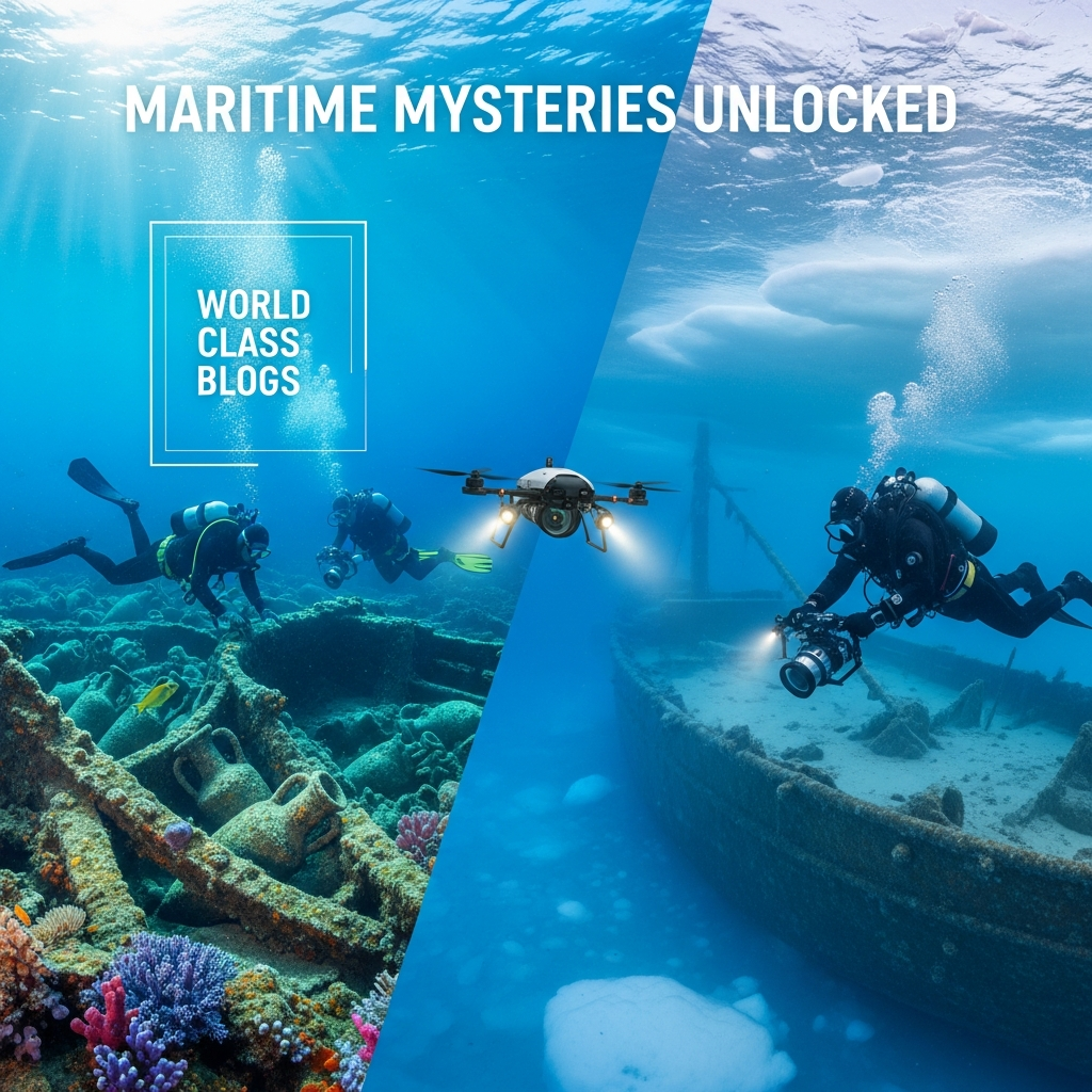
Maritime Mysteries Unlocked: Underwater Archaeology from the Mediterranean to the Arctic
Dive into the world of underwater archaeology. Our 2026 guide explores how ROVs, photogrammetry, and saturation divers unlock sunken secrets—from ancient Greek ships to lost polar expeditions. underwater archaeology, maritime archaeology, shipwrecks, submerged cities, photogrammetry, ROV, saturation diving, cultural heritage, ocean exploration, nautical archaeology, UNESCO Convention, Black Sea, Thonis-Heracleion, Franklin Expedition, how do archaeologists map shipwrecks, latest underwater discoveries 2026, what is photogrammetry in archaeology, difference between ROV and AUV, climate change impact on shipwrecks, Black Sea shipwrecks, Franklin Expedition, Thonis-Heracleion, in-situ preservation, UNESCO convention, nautical archaeology.
The complete technological pipeline of modern underwater archaeology, from wide-area discovery to micro-scale analysis, emphasizing the non-intrusive, data-first approach.
Introduction: The Silent Archives Beneath the Waves
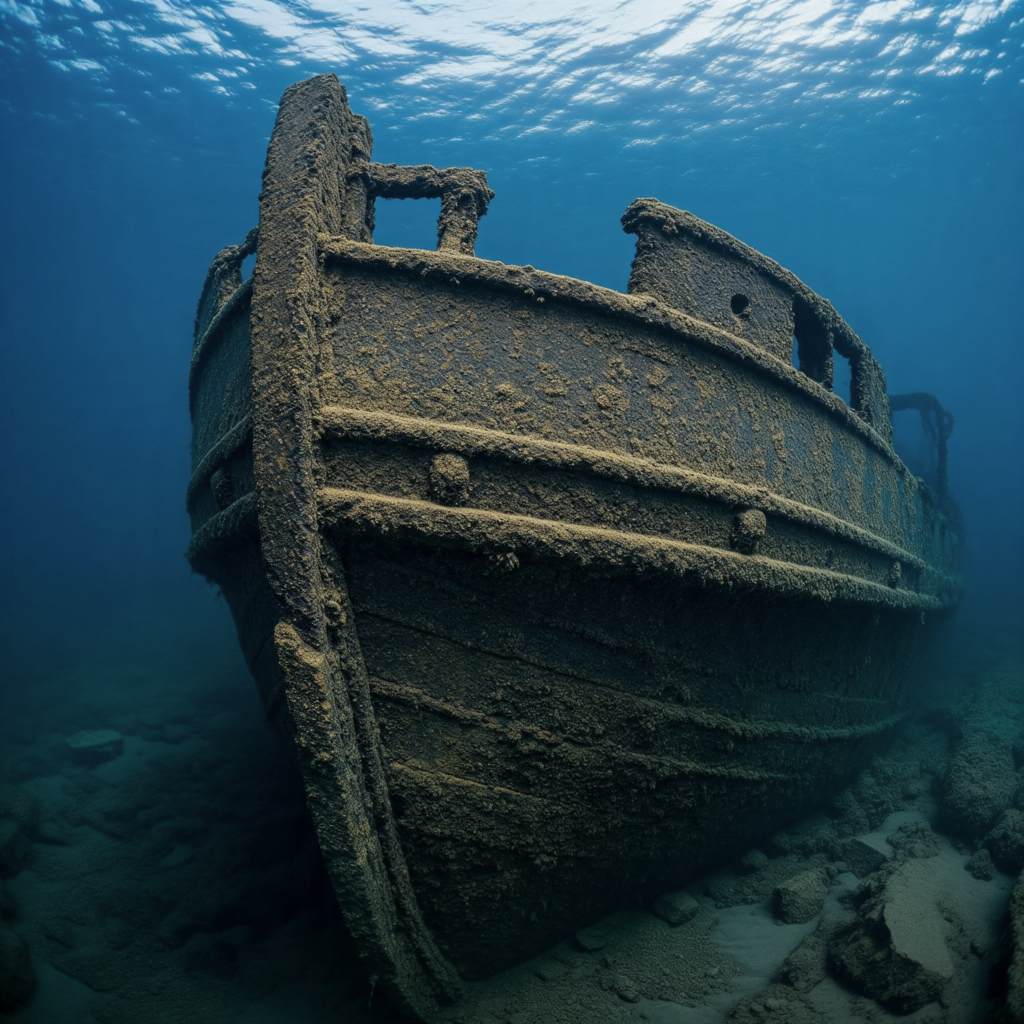
In my experience speaking with maritime archaeologists, there’s a common refrain: the ocean floor is the planet’s greatest untapped museum. It holds not just shipwrecks, but submerged cities, drowned landscapes, and the material record of millennia of human interaction with the sea. These sites are unique time capsules, sealed in cold, dark, and often anoxic (oxygen-free) environments that can preserve organic materials—wood, fabric, leather, even food—for thousands of years in a state impossible on land.
Underwater archaeology is no longer the domain of treasure hunters. It is a rigorous, scientific discipline that combines the thrill of exploration with the precision of forensic science. Its goal is not recovery for recovery’s sake, but in-situ preservation and understanding. Every intact amphora, every copper sheathing nail, every sailor’s personal effect is a data point in a vast story of global trade, technological innovation, cultural exchange, and, often, human tragedy.
This article will submerge you in the methods and marvels of this field. We’ll explore the cutting-edge technologies—from autonomous robots to high-definition 3D modeling—that are revolutionizing exploration, and journey to iconic sites from the wine-dark seas of the ancient Mediterranean to the icy graves of Victorian polar explorers. We’ll also confront the urgent challenges: from looting and climate change to the ethical dilemmas of disturbing these underwater graves.
Part 1: Background & Context – From Sponge Divers to Science
The story of underwater archaeology begins with serendipity and salvage.
The Early Days: Treasure & Discovery
For centuries, shipwrecks were targets for salvage divers seeking bullion. The field’s scientific birth is often traced to the 1900 discovery of the Antikythera mechanism by sponge divers off Greece—a stunningly complex ancient astronomical calculator found amid a Roman-era wreck. However, early efforts were destructive, focused on artifact recovery with little documentation.
The Revolution: Scuba & Systematic Method
The invention of the Aqualung by Cousteau and Gagnan in 1943 was the first major technological leap, giving archaeologists direct, prolonged access to sites. Pioneers like George Bass in the 1960s applied terrestrial archaeological principles underwater at sites like the Cape Gelidonya Bronze Age wreck off Turkey, proving shipwrecks could be excavated as systematically as land sites.
The Modern Paradigm: Preservation In Situ & Non-Intrusive Survey
A philosophical and legal shift occurred in the late 20th century, crystallized by the 2001 UNESCO Convention on the Protection of the Underwater Cultural Heritage. Its core principles are:
- In-situ preservation as the first option. The site itself is the primary artifact; recovery is a last resort.
- No commercial exploitation. It rejects the “finders-keepers” model of treasure hunting.
- Training and information sharing. It promotes scientific standards and public access to knowledge.
This framework guides all professional underwater archaeology today, turning it from a salvage operation into a true discipline of preservation and study.
Part 2: Key Concepts Defined
- In-Situ Preservation: The practice of studying, monitoring, and protecting an archaeological site in its original location on the seabed, minimizing disturbance.
- Nautical vs. Maritime Archaeology: Nautical archaeology focuses specifically on vessels and their construction/operation. Maritime archaeology is broader, encompassing all human interaction with the sea: ports, submerged landscapes, fishing structures, and shipwrecks.
- Remote Sensing: The use of tools to detect and map sites without direct contact.
- Side-Scan Sonar: Towed behind a vessel, it creates a detailed, photo-like image of the seafloor, highlighting anomalies like wrecks.
- Multibeam Echosounder: Emits a fan of sound waves to create precise 3D bathymetric (depth) maps of the seabed.
- Sub-bottom Profiler: Uses low-frequency sound to penetrate sediments and image buried features (like a ship buried under mud).
- ROV (Remotely Operated Vehicle) & AUV (Autonomous Underwater Vehicle): Uncrewed robotic submarines. ROVs are tethered and piloted in real-time from a ship, equipped with cameras, sonar, and manipulator arms. AUVs are pre-programmed to run survey grids independently, collecting vast amounts of sonar data.
- Photogrammetry: The cornerstone of modern underwater recording. Thousands of overlapping photographs of a site are processed by software (like Agisoft Metashape) to create a millimeter-accurate, photorealistic 3D digital model. This becomes the permanent, measurable record of the site before any excavation.
- Saturation Diving: For deep sites (beyond 50m/164ft), archaeologists use diving systems where they live in pressurized chambers on a support ship for weeks, breathing a helium-oxygen mix. They are transferred to the seabed in a diving bell, allowing them 6-8 hours of work time daily without risk of decompression sickness.
- Anoxic Environment: Water devoid of oxygen. This inhibits the bacteria and wood-boring organisms (like teredo worms) that normally destroy organic materials. The Black Sea, with its anoxic layer below 150m, is a world-class preservation environment.
- Site Formation Process: The study of how a shipwreck transforms from a functioning vessel to an archaeological site—considering sinking dynamics, current action, sediment deposition, and biological colonization.
Part 3: How It Works – The Modern Underwater Excavation Protocol
A professional underwater excavation is a meticulously planned, multi-stage operation blending advanced tech and skilled diver-archaeologists.
Phase 1: Remote Survey & Discovery
A research vessel surveys a target area (e.g., a known trade route) using AUVs equipped with side-scan sonar and multibeam. The data is processed to identify potential targets (“anomalies”). An ROV is then deployed for a visual inspection to confirm if an anomaly is cultural (a wreck) or natural (a rock outcrop).
Phase 2: Pre-Disturbance Recording & Site Plan
Once a site is confirmed, the goal is to record everything before moving a single object.
- Photogrammetric Baseline: Divers or an ROV fly systematic photo/video transects over the entire site. This data is processed into the master 3D model.
- Geophysical Survey: High-resolution sub-bottom profiling maps the sediment layers and any buried structures.
- Environmental Monitoring: Sensors are placed to record current, temperature, salinity, and oxygen levels to understand preservation conditions.
Phase 3: Excavation & In-Situ Analysis
If excavation is justified (e.g., to answer a specific research question or due to an imminent threat), it proceeds with surgical precision.
- Grid Establishment: A physical or virtual grid is laid over the site.
- Sediment Removal: Hand-held airlifts (underwater suction devices) or gentle water dredges are used to remove sediment. The slurry is filtered on deck for micro-artifacts (seeds, beads, insect remains).
- In-Situ Recording: As artifacts are exposed, they are photographed, measured, and tagged within the 3D model before being lifted. Their precise location and orientation are crucial data.
- On-Site Conservation: Fragile items may receive first-aid stabilization (e.g., keeping wood wet) on the support vessel before transport to a full conservation lab.
Phase 4: Post-Excavation, Conservation & Curation
This is where the “archaeology” truly happens, often lasting decades longer than the dive season.
- Conservation: A colossal undertaking. Waterlogged wood must be slowly impregnated with polyethylene glycol (PEG) in a multi-year process. Metals undergo electrolytic reduction. Every artifact requires specialized treatment.
- Analysis & Synthesis: Artifacts are studied: wood species identify sourcing; ceramics are sourced and dated; DNA analysis of residue in amphorae reveals contents (wine, olive oil, fish sauce). This data reconstructs the ship’s origin, cargo, route, and final voyage.
- Public Outreach & Virtual Access: The 3D models become virtual dive sites online. Museums create exhibits. The story is shared, fulfilling the UNESCO mandate.
Key Takeaway Box: The Underwater Archaeologist’s Toolkit: From Sonar to Synthetics
Discovery: AUVs with Side-Scan Sonar / Multibeam
Inspection: ROVs with HD Cameras & Manipulators
Recording: Photogrammetry for 3D Modeling / DSLR Cameras
Excavation: Airlifts / Water Dredges / Hand Trowels
Diving Support: Saturation Systems (Deep) / Mixed Gas & Rebreathers (Mid-Depth) / Standard SCUBA (Shallow)
Conservation: PEG Tanks / Electrolysis Vats / Freeze-Dryers
Every tool prioritizes minimal disturbance and maximum data capture.
Part 4: Why It’s Important – More Than Sunken Treasure
The value of underwater archaeology extends far beyond beautiful artifacts.
1. Filling the Gaps in the Historical Record:
History is written by the literate and victorious. Shipwrecks and submerged ports offer an unfiltered, “snapshot” view of everyday commerce, technology, and life. The Uluburun wreck (14th century BCE, Turkey) revealed a king’s ransom in raw materials (copper, tin, glass, ebony) from a dozen cultures, detailing Bronze Age trade networks with a specificity no clay tablet could provide.
2. Preserving the Organic Past:
The sea preserves what land destroys. The Vasa (1628, Sweden) and Mary Rose (1545, England) are floating time capsules of Tudor/Carolingian society, with leather, textiles, tools, and human remains intact. This offers unparalleled insight into daily life, diet, health, and craftsmanship.
3. Understanding Climate Change & Human Adaptation:
Submerged landscapes, like Doggerland (the land bridge between Britain and Europe) or Beringia, are archives of past climate shifts and early human migration routes. Studying them provides critical context for current sea-level rise.
4. Advancing Marine Science & Technology:
The field drives innovation in robotics, remote sensing, and materials science. Techniques developed for archaeology are used in offshore energy, pipeline inspection, and environmental monitoring, creating a virtuous cycle of technological progress.
5. Ethical Stewardship & Combatting Looting:
Professional archaeology provides the ethical counter-model to commercial treasure hunting, which destroys context for profit. By demonstrating the scientific and public value of in-situ preservation, it builds public support for protecting underwater heritage as part of our shared human legacy. This stewardship mindset is crucial for all heritage management, as discussed in our Nonprofit Hub resources.
Part 5: Sustainability in the Future – Preserving a Fragile Frontier
The underwater cultural heritage is under unprecedented threat, making sustainable practices non-negotiable.
- The Looting Epidemic: With the advent of cheap side-scan sonar and deep-water ROVs, looters can find and strip sites faster than ever. The 2024 plunder of a 17th-century Spanish galleon in international waters by a commercial outfit highlighted the legal gaps and the need for stronger enforcement of the UNESCO Convention.
- Climate Change & Ocean Acidification: Warming waters expand the range of wood-boring organisms. Acidification accelerates the corrosion of metal wrecks. Increased storm intensity and coastal erosion threaten shallow-water sites. Mitigation strategies now include cathodic protection (sacrificial anodes) for metal wrecks and experimental reburial of sites with geotextile sandbags to recreate stable conditions.
- Development & Trawling: Port construction, cable laying, and bottom trawling fishing destroy countless unknown sites annually. Maritime Spatial Planning (MSP) is a new frontier, where archaeologists work with governments and industries to map and avoid sensitive zones.
- The Carbon Footprint of Research: Support vessels burn significant fuel. The field is moving towards green archaeology: using sail-powered research vessels, optimizing survey plans with AI to reduce sea time, and sharing vessel space with oceanographic missions.
- Digital Preservation as a Sustainable Legacy: The push for complete digital documentation is a sustainability win. If a site is ultimately destroyed by nature or humans, its perfect 3D record and associated data survive for future study and virtual public engagement.
Part 6: Common Misconceptions
- “It’s all about finding gold and treasure.” FALSE. Most shipwrecks are ordinary trading vessels, fishing boats, or warships carrying mundane cargo. Their historical value lies in their typicality, not their precious metal content. Professional archaeologists are scientists, not treasure hunters.
- “Archaeologists take everything out of the water.” FALSE. In-situ preservation is the default. Excavation is a destructive process of last resort, undertaken only when the research questions cannot be answered otherwise or the site is imminently threatened.
- “The deep ocean is a dead, quiet place perfect for preservation.” NOT ENTIRELY. While anoxic depths like the Black Sea are phenomenal, most of the ocean is dynamic. Currents scour sites, organisms bore into wood, and corrosion is constant. Each site has a “taphonomic clock” counting down to its eventual disintegration.
- “You need to be a Navy SEAL to be an underwater archaeologist.” FALSE. While excellent diving skills, physical fitness, and comfort in challenging conditions are required, the primary qualification is a graduate degree in archaeology or a related field. The best practitioners are archaeologists first, divers second.
- “Finding the wreck is the hard part.” NOT ANYMORE. With modern sonar, finding anomalies is efficient. The immense, decades-long challenge is the excavation, conservation, analysis, and publication—the “post-discovery” work that can cost 10-100 times more than the initial survey.
Part 7: Recent Developments (2024-2025)
- AI-Powered Sonar Analysis: Machine learning algorithms are now trained to automatically classify sonar images, distinguishing shipwrecks from rocks, pipelines, or modern debris with over 95% accuracy. This is speeding up the analysis of the terabytes of data collected by AUVs.
- Laser-Induced Breakdown Spectroscopy (LIBS) In Situ: A new handheld tool allows divers to perform elemental analysis of artifacts on the seabed. By firing a laser at a surface (e.g., a metal ingot or pottery), it can determine its composition without sampling, instantly providing data on trade and provenance.
- The “Shipworm Armageddon” in the Baltic: The Baltic Sea, once too cold and brackish for the teredo shipworm, is now seeing its northward migration due to warming waters. A 2025 report projects that thousands of perfectly preserved wooden wrecks, including Viking ships, could be consumed within decades, triggering a rescue archaeology crisis.
- Virtual Reality (VR) for Public Engagement & Research: Hyper-detailed 3D models are now being rendered in VR. Researchers can “swim” through a photorealistic wreck site from their lab, taking measurements and discussing features collaboratively. Museums are launching VR experiences that put visitors on the seabed.
- Ancient DNA from Shipwreck Sediments: Pioneering work extracts sediment DNA (sedaDNA) from the mud inside amphorae and bilges. This can identify the contents (olives, grapes, spices) and even the microbiome of the ship’s crew, revealing diseases and diet.
Part 8: Success Stories & Real-Life Examples
1. The Black Sea Maritime Archaeology Project (MAP):
A paradigm-shifting survey from 2015-2023. Using AUVs and ROVs, it discovered over 60 exceptionally preserved shipwrecks in the anoxic depths, spanning 2,500 years of maritime history. The finds include a complete, upright Classical Greek merchant vessel from 400 BCE, its mast, rudders, and rowing benches intact as if it sank yesterday. This project revolutionized our understanding of ancient ship design and trade, all through remote survey with minimal intrusion.
2. The Franklin Expedition (1845-1848) – HMS Erebus & Terror:
The discovery of these two lost polar exploration ships in the Canadian Arctic (2014 & 2016) is a masterclass in interdisciplinary work. Using Inuit oral history combined with side-scan sonar, archaeologists found the ships remarkably preserved in the icy water. The ongoing excavation, led by Parks Canada, involves short dive windows in extreme conditions. Artifacts like sealed writing desks, intact plates, and personal items are slowly revealing the final days of the crew, rewriting the narrative of this tragic expedition.
3. Thonis-Heracleion & Canopus, Egypt:
Submerged by earthquakes and sea-level rise around the 8th century CE, these two major ports at the Nile Delta mouth were legendary. Rediscovered by Franck Goddio’s team in the 1990s and still under excavation, they have yielded colossal statues, inscribed stelae, temple remains, and a fleet of ancient shipwrecks. They provide a physical map of a bustling Greco-Egyptian trading hub mentioned by Herodotus, literally bringing myth into history.
4. The 3D Digital Resurrection of La Lune (1664):
The warship of Louis XIV was sunk off Toulon, France. Instead of a costly, destructive excavation, the French Ministry of Culture undertook a complete photogrammetric recording project. Every artifact’s position was logged in a massive 3D model. This digital twin allows unlimited study and public exploration, while the physical site remains undisturbed on the seabed—a perfect model of in-situ preservation through digital means.
Part 9: Conclusion and Key Takeaways
Underwater archaeology has matured from an adventurous sidebar into a central pillar of our understanding of the human past. It forces us to look beyond coastlines and see the oceans not as barriers, but as the connective highways of pre-modern globalization.
The key lessons from the deep are clear:
- Context is Everything: An artifact lifted without recording its precise relationship to the ship, the cargo, and other objects is a trinket. Its true story is lost. The seabed context is the primary document.
- Technology is an Enabler, Not an End: ROVs, AUVs, and photogrammetry are incredible tools, but they serve the archaeological question. The most important tool remains the trained, ethical human mind asking “why?”
- The Deep is a Library, Not a Treasure Chest: The greatest value of these sites is informational. They hold data on climate, trade, technology, and daily life that exists nowhere else. Preserving this library is a global responsibility.
- We are in a Race Against Time: Climate change, acidification, and human activity are degrading these sites faster than we can study them. The field must prioritize threat assessment, digital archiving, and sustainable mitigation.
- These are Often Gravesites: Many shipwrecks are the final resting place of sailors. Underwater archaeologists operate with a solemn respect, treating human remains with dignity and often advocating for non-intrusive commemoration.
Final Thought: What I’ve found, in conversations with those who work in the silent, weightless world of underwater sites, is a profound sense of responsibility. They are the stewards of stories suspended between sea and sediment. Their work ensures that the final voyage of a Greek trader, the last moments of a polar explorer, or the submerged streets of a great port are not erased by time or greed, but are recovered, remembered, and reintegrated into the grand narrative of who we are. In an age turning increasingly to the oceans for resources, this work reminds us that our greatest submerged resource is our own history.
Part 10: FAQs (Frequently Asked Questions)
1. What’s the deepest shipwreck ever excavated?
The SS Rio Grande, a WWII German blockade runner in the Atlantic, at ~5,762 meters (18,904 ft). It has been surveyed by an ROV but not excavated. The deepest traditional archaeological excavation is likely the US Civil War wreck of the USS Monitor (turret recovery) at ~70m (230 ft).
2. How do you know where to look for shipwrecks?
Research begins in archives: ship logs, insurance records, survivor accounts, port documents. This provides a “search box.” Archaeologists then look for geographic choke points (capes, straits) near ports or along well-documented trade routes.
3. Who owns a shipwreck in international waters?
It’s complex. The UNESCO 2001 Convention applies to states that have ratified it, advocating for in-situ preservation and cooperative protection. For warships, sovereign immunity often applies (they remain property of the flag nation). For commercial wrecks, salvage law can clash with archaeological principles, creating legal gray areas.
4. How long does it take to excavate a shipwreck?
A large, deep-water wreck can take decades. The Vasa (in a harbor) took years to raise but decades to conserve. The Mary Rose excavation spanned 1979-1982, with conservation and analysis ongoing. Deep projects like Franklin are planned in 5-10 year phases.
5. What happens to all the conserved artifacts?
They are curated in perpetuity by museums or government agencies. The Bodrum Museum of Underwater Archaeology (Turkey) and the Vasa Museum (Sweden) are world-class examples. The immense cost of long-term curation is a major consideration before any excavation begins.
6. Can metal detectors be used underwater?
Yes, magnetometers are a key remote sensing tool, detecting ferrous metals (iron, steel). They are towed behind a vessel to find wrecks or scattered cargo. Pulse induction metal detectors are used by divers for pinpoint locating.
7. What’s the difference between an ROV and an AUV?
An ROV is connected to a ship by a tether (umbilical) that provides power and real-time communication. It’s piloted. An AUV is a free-swimming robot, pre-programmed with a mission. It has a battery, collects data independently, and returns to be downloaded. AUVs are for wide-area survey; ROVs are for close-up work.
8. How do you map a site in 3D if the water is murky?
Photogrammetry requires visibility. In low-visibility environments, archaeologists use acoustic imaging like sector-scanning sonar mounted on an ROV to create 3D sonar models. While less photorealistic, they provide accurate dimensional data.
9. Are there underwater archaeology degrees?
Yes. Many universities offer specialized MA and PhD programs (e.g., University of Southampton, Texas A&M, University of Malta). They combine an archaeology curriculum with diving training (often culminating in AAUS – American Academy of Underwater Sciences – certification).
10. How is climate change specifically affecting wrecks?
- Warmer water: Increases biological degradation (shipworms, bacteria).
- Ocean acidification: Dissolves calcium carbonate (shells, ballast stones) and accelerates metal corrosion.
- Stronger storms: Resuspend sediments, scouring and exposing buried sites.
- Sea-level rise: Increases wave energy and erosion on coastal and shallow sites.
11. What is “keys under the mat” archaeology?
A term for the incredible preservation in anoxic environments like the Black Sea. When a ship sinks, objects often remain exactly where they were placed or fell, as if the crew just left—the “keys” are still under the “mat.”
12. Have any submerged cities been fully excavated?
No, due to scale and cost. Sites like Pavlopetri (Greece) or Baia (Italy) are extensively surveyed and partially excavated, but a full excavation of a city is a multi-generational project. Digital mapping is often the primary tool.
13. What role do recreational divers play?
Trained volunteer divers are crucial for many shallow-water projects, assisting with surveys and monitoring. However, they are taught to “take only pictures, leave only bubbles.” Responsible divers report findings to authorities without disturbing them.
14. How is robotics changing the field?
Robotics allows access to dangerous or ultra-deep sites impossible for divers. They enable longer “bottom time,” precise manipulation, and consistent data collection. The human archaeologist is increasingly a supervisor in a control room, analyzing real-time video and data feeds.
15. What’s the most surprising thing found on a shipwreck?
Personal items always resonate: a whalebone toothbrush with boar bristles on the Mary Rose; a sealed jar of ginger on the Vasa; a sailor’s perfectly preserved leather shoe on a Black Sea wreck. These objects connect us instantly to individual lives.
16. How does this field interact with offshore industries (oil, wind)?
Increasingly through cultural resource management (CRM). Before laying a pipeline or building a wind farm, companies are required to survey the seafloor. Archaeologists are hired to ensure significant sites are identified and avoided or mitigated, a process of careful negotiation and planning similar to Global Supply Chain Management for heritage.
17. Can you reconstruct an entire ship from its wreck?
Often, yes. By studying the fastenings, wood species, and hull shape, naval architects can create line drawings and even physical reconstructions. The Kyrenia II is a sailing replica of a 4th-century BCE Greek merchant ship whose wreck was excavated off Cyprus.
18. What’s the biggest ethical dilemma in the field?
Balancing the need for knowledge against the principle of in-situ preservation. When is excavation justified? This is debated for every major project, weighing research potential against the irreversible act of disturbance.
19. How can I support underwater archaeology?
Advocate for the ratification and enforcement of the UNESCO 2001 Convention in your country. Support museums that ethically curate underwater collections. Choose dive operators who respect heritage sites. Donate to reputable research institutions.
20. Where can I see the latest discoveries?
Follow organizations: NOAA’s Office of Ocean Exploration, Parks Canada’s Underwater Archaeology Team, the European Institute of Underwater Archaeology (IEASM), and projects like Black Sea MAP. Social media accounts of these groups often share stunning real-time imagery.
Part 11: About the Author
This article was authored by the World Class Blogs Editorial Team, a group committed to exploring the frontiers of human knowledge and technological innovation. Our writers and researchers have a passion for disciplines that combine adventure with rigorous science, and we strive to bring the wonders of fields like underwater archaeology to a broad audience with accuracy and narrative power. We believe in the preservation of our shared global heritage as a foundation for understanding our present. Learn more about our mission on our About Us page.
Part 12: Free Resources
- Virtual Dive Sites & Museums:
- The Virtual Museum of the Franklin Expedition (Parks Canada)
- Billion Wreck Map – An interactive global map of major shipwrecks.
- The Mary Rose Virtual Museum – Extensive online collections and 3D models.
- Educational Platforms & Documentaries:
- NOAA Ocean Explorer Website: Live feeds, mission logs, and educational materials from current expeditions.
- “Drain the Oceans” (National Geographic) – Uses CGI to “remove” water and reveal submerged landscapes.
- “Shipwreck Men” and “Deep Sea Detectives” – Series focusing on archaeological methods.
- Key Organizations:
- The Advisory Council on Underwater Archaeology (ACUA)
- The Nautical Archaeology Society (NAS) – Offers training and certification for non-professionals.
- UNESCO – Underwater Cultural Heritage Unit
- For More on Interdisciplinary Innovation: The technological convergence in underwater archaeology—robotics, AI, material science—is a powerful example of modern problem-solving. For insights into how such integration drives success in other fields, explore our partner network’s guide on Strategic Alliance Models.
Part 13: Discussion
The ocean floor holds countless untold stories. As technology makes these stories more accessible, how do we balance exploration with preservation? Should some wrecks, especially war graves, be left entirely untouched as memorials? How can we, as a global community, better protect this submerged heritage from looters and climate change?
We welcome your thoughts on these profound questions. For further discussion or to suggest other scientific frontiers, please contact us via our Contact Us page. Dive into more in-depth explorations in our main Blogs category and our curated Our Focus sections.